How to find us
Location
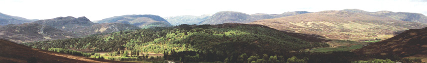
Amat lies inland from the east coast about 50 miles north of Inverness. The nearest villages are Ardgay (9 miles) and Bonar Bridge (10 miles).
Open a larger more detailed map in a new windowBy road, the journey time from Inverness is about 1 hour.
See the tabs below for more detailed maps and instructions on how to get to Amat.
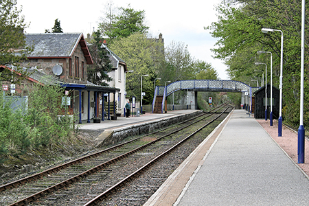
There is an unmanned railway station in Ardgay with up to 5 trains daily from Inverness, running to Wick and Thurso in the north. The journey time is about 1 hour and 30 minutes.
Inverness has a direct rail link to London King's Cross and a direct sleeper service to London Euston.
See the Scotrail website for times and fares. (Opens in a new window).
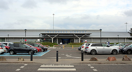
Dalcross Airport
attrib: Braveheart, CC BY-SA 4.0 via Wikimedia Commons
Dalcross Airport is located about 9 miles east of Inverness and is well served by taxis. A bus service operates up to every 30 minutes between the airport and the city. The journey time is about 33 minutes.
See the Stagecoach website for times and fares. (Opens in a new window).
The modern airport operates around 330 scheduled flights each week to destinations in the UK including London Gatwick and London Heathrow.
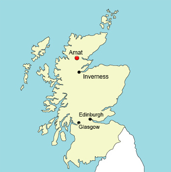
Location of Amat in the Highlands
Scroll down to see directions.
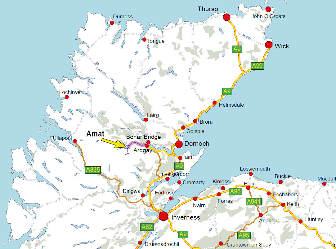
Map of Highlands showing location of Amat
Directions from Inverness to Ardgay
If driving from Inverness, this is the most direct route.
From the Longman Roundabout in Inverness (This is on the main A9) take the exit which crosses over Kessock Bridge which will be signposted A9 to Thurso.
Continue along the dual carriageway for about 6 miles to Tore Roundabout.
At Tore Roundabout, take the 3rd exit onto a single carriageway signposted A9 Thurso and A99 Wick.
Continue for about another 6 miles, over the Black Isle and Cromarty Firth Bridge until you come to Cromarty Roundabout.
Take the 2nd exit still on the A9 to Wick and Thurso and continue for about 4 miles.
Take the B9176 for Ardgay and Bonar Bridge on the left which will also be signposted for Skiach Services.
Stay on the B9176 for about 16 miles. This is known as the Struie road until you come to the end, which will join onto the A836 from Tain to Ardgay.
At this junction, bear left and continue for about 3 to 4 miles and you will arrive in Ardgay.
Click on the next tab for a more detailed map and directions from Ardgay to Amat.
Ardgay to Amat
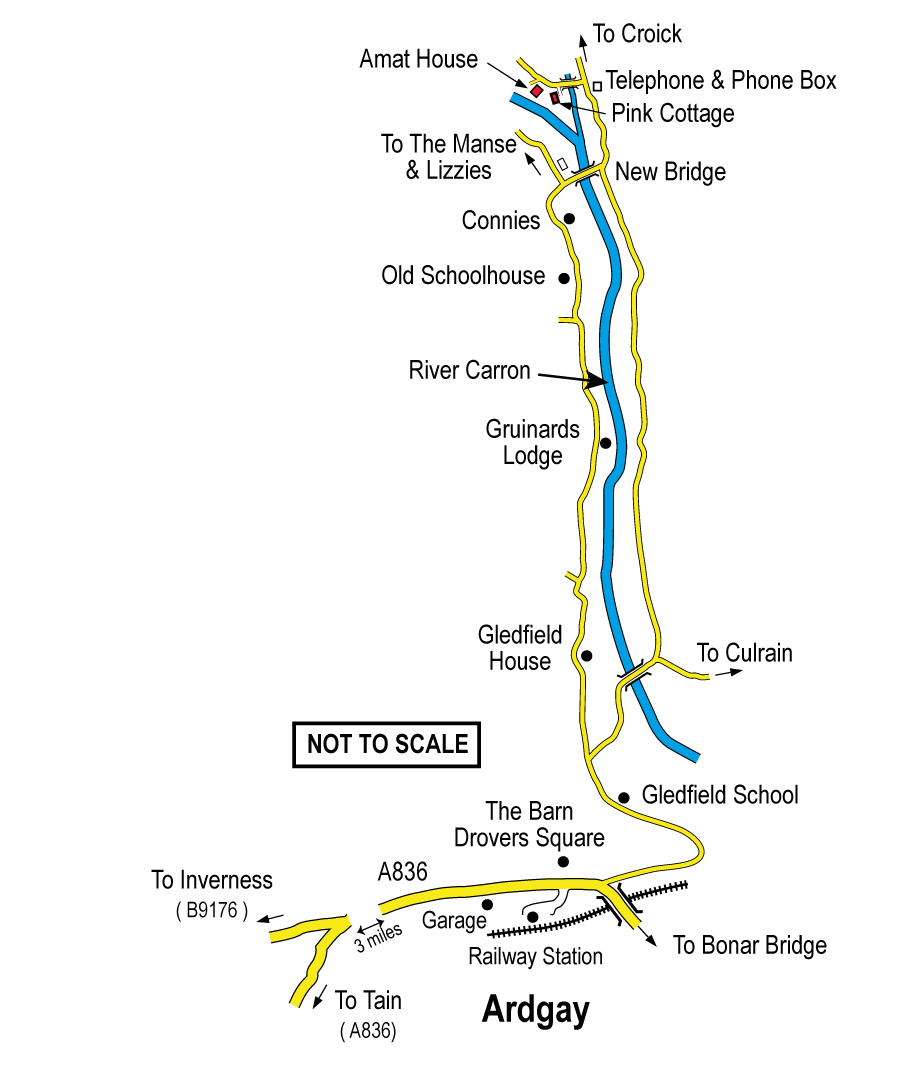
Map showing route from Ardgay to Amat
Directions from Ardgay to Amat
The road bends to the right just past The Barn and Drovers Square. Take Church Road which is on the left, right on the bend, next to the Kyle of Sutherland Fishery Board shop.
Continue on this road for just under 1 mile past Ronnies Taxis and Gledfield School, both on the right. Just after the school there is a road branching off on the left (although the road you are on bends to the right).
You may take either road to Amat.
If you take the road on the left (it is slightly quicker), continue for about 7.3 miles past Gledfield, Dounie, Gruinards and the old Schoolhouse until you see the Iron Bridge.
Just before the Iron Bridge on the left you will see the old Church. There is a road immediately on the left before it, and also before the Iron Bridge.
Take this road if you are going to the Manse or Lizzie's Cottage.
The Manse is about 0.6 miles along this road on the left. You cannot miss it as the bay window is level with the road.
Lizzie's Cottage is a further 0.4 miles along this road right at the end. To gain access to Lizzie's Cottage travel along the short track.
From Ardgay, if you stayed on Church Road which bends to the right after Gledfield School, you would travel on the north side of the river, for about 7.3 miles, past the turning to Culrain and further on past Braelangwell until you arrived at the Iron Bridge from the other side.
For The Manse and Lizzie's Cottage, cross over the Iron Bridge and take the road on the right immediately past the old Church
As before, the Manse is about 0.6 miles along this road on the left. and Lizzie's Cottage is a further 0.4 miles right at the end. To gain access to Lizzie's Cottage travel along the short track.
Please see the next tab for a map of the estate.
Map of Amat
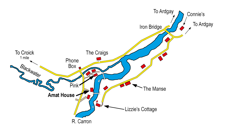
Map of Amat Estate
This map shows the different properties on the estate and where they are located.
LEGAL INFORMATION
The information and material on this site is provided in good faith for general information only and no part shall form any part of a contract. Amat Estate and its agents assume no responsibility for the accuracy of any particular statement and accept no liability for any loss or damage which may arise from reliance upon the information contained on this website. Links to other websites from these pages are for general information only and Amat Estate and its agents accept no responsibility or liability for access to other material on any website which is linked from or to this website.
© 2021 amatsalmon.com